New satellite view of Camp Fire as it burned through Paradise
Google's Earth Engine allows unique images of fire burning through Paradise, and clues to fires origin

November 15, 2018
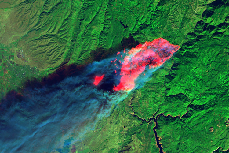
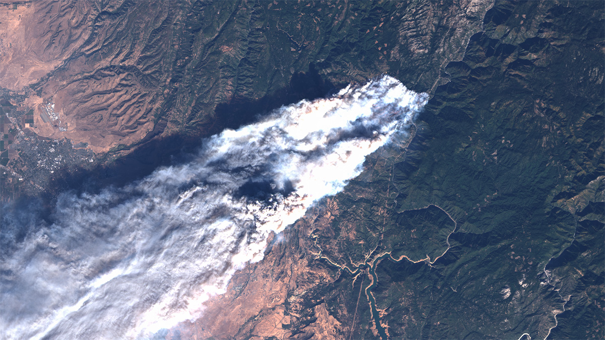
Satellite images of the area around Paradise, California, on the morning of Nov. 8 captured the Camp Fire when it was only four hours old, yet had already burned halfway through the city.
Overlaid with earlier high-resolution images of the city’s buildings and surrounding landscape, the images clearly indicate the buildings that had likely burned by 10:45 a.m. that Thursday, as well as the rapidly leapfrogging flames and the path of destruction the fire had created since its ignition at around 6:30 a.m.
The northeastern, upwind edge of the burn lies beneath and parallel to three high-tension power lines running along Highway 70, about a mile and a half northeast of a town called Pulga and a site identified as a possible origin of the fire.
So far, the Camp Fire has scorched 140,000 acres, left at least 56 people dead and destroyed more than 8,700 residences, making it the most destructive fire in California history. It is only 40 percent contained.
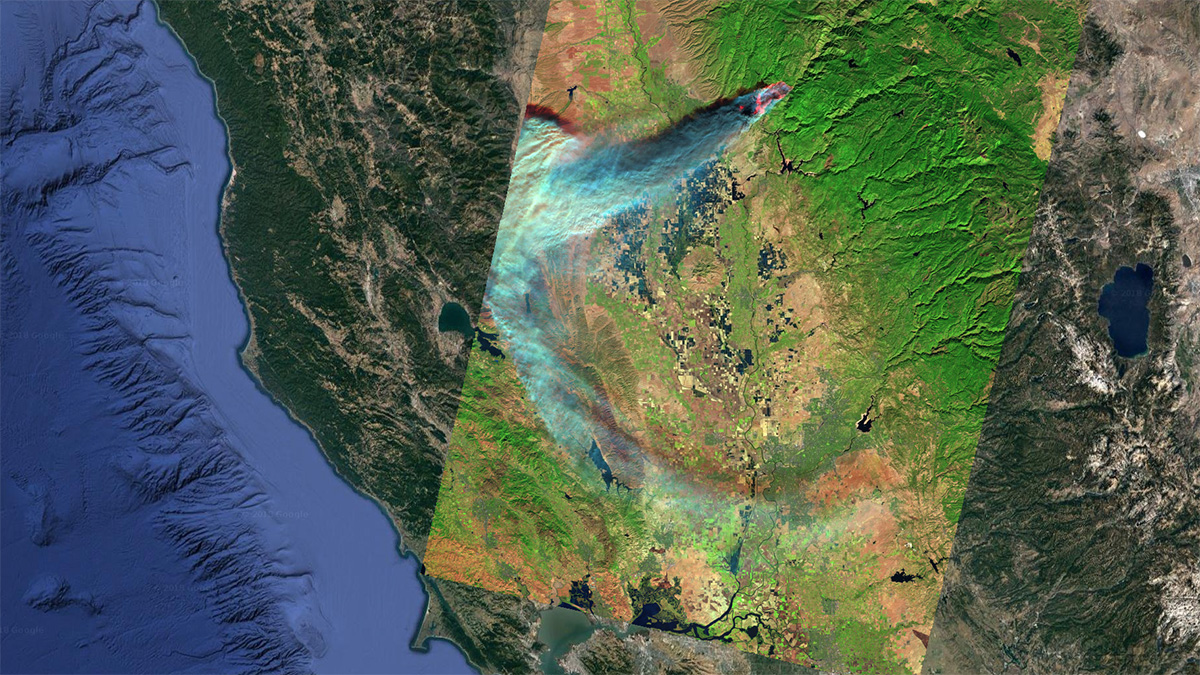
The images were generated by Jeff Chambers, a UC Berkeley professor of geography, using Google’s Earth Engine, which combines an analysis platform and detailed base maps with large storage and daily downloads of publicly available Earth-imaging data from orbiting satellites. The Landsat 8 satellite happened to snap its once-every-16-days shot of that area at 10:45 a.m. on Thursday, Nov. 8.
The satellite recorded visible and infrared wavelengths. Short-wavelength infrared (SWIR) light (1.2- to 3-micron wavelength) is captured in two bands with Landsat 8, and these SWIR wavelengths are emitted by burning materials and penetrate smoke and aerosols, allowing a detailed picture of the fire’s progress. As assembled by Chambers, the infrared signature of fire is an eerie red wash over Earth Engine’s base map of homes and businesses in Paradise.
“It’s astonishing,” Chambers said. “You can see the fire burning right through the city. The burn front at 10:45 a.m. on Thursday morning was that far into the city. Earth Engine tools allow this type of rapid analysis, and I think it’s important to get this out there to the public right away.”

Chambers used the satellite data to clock the fire’s speed at about 5 kilometers (3 miles) per hour during its first four hours, driven in part by flying embers that caused the fire to leapfrog up to 4 kilometers, or 2.5 miles, ahead of the advancing fire front.
“People need to understand how quickly these fires can propagate. Early warning is so critical here,” he said.
Chambers is a field ecologist and biogeographer who uses remote sensing to augment his ground studies of how areas are impacted and recover after hurricanes, droughts, fires and other natural disasters. Earlier this year, he published results of rapid mapping of the damage to Puerto Rico’s forests caused by 2017’s Hurricane Maria, and a publication for peer review is nearing completion on that work.
On Saturday, Nov. 10, Chambers pulled up Landsat data from 10:45 a.m. Nov. 8, and manipulated it to see what could be learned. Such information, if it had been available immediately after the satellite obtained the images and been updated frequently, might have been invaluable to firefighters.
“You can see the way in which the structure of the burn is aligned with the built environment,” he said. “At 10:45 in the morning, all these structures were engulfed in flames. You can see that clearly in the image and start counting the hundreds of homes burned.”
Chambers emphasized that the Camp Fire is not a forest fire, but a wildland fire made dangerous by its proximity to dense human habitation.
“The vegetation of the ignition area is not a forested region, it’s a complex mosaic of grasses, shrubs and forest patches, with downed and dead woody debris and urban structures,” he said.
Chambers plans within a few weeks to build a user interface that can interact with his Earth Engine code, allowing anyone to manipulate the images and zoom in on areas of interest.


